
Thank you for supporting this site ❤️
Make a donation
Make a donation
Herrán topographic map
Click on the map to display elevation.
Thank you for supporting this site ❤️
Make a donation
Make a donation
About this map
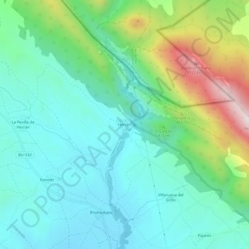
Name: Herrán topographic map, elevation, terrain.
Location: Herrán, Valle de Tobalina, Burgos, Castille-et-León, Espagne (42.80331 -3.24922 42.84331 -3.20922)
Average elevation: 730 m
Minimum elevation: 541 m
Maximum elevation: 1,272 m
Thank you for supporting this site ❤️
Make a donation
Make a donation