
Thank you for supporting this site ❤️
Make a donation
Make a donation
Isère topographic map
Click on the map to display elevation.
Thank you for supporting this site ❤️
Make a donation
Make a donation
About this map
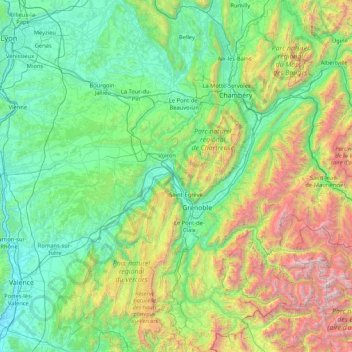
Name: Isère topographic map, elevation, terrain.
Location: Isère, Auvergne-Rhône-Alpes, Metropolitan France, France (44.69589 4.74157 45.88363 6.35808)
Average elevation: 868 m
Minimum elevation: 92 m
Maximum elevation: 3,931 m
Thank you for supporting this site ❤️
Make a donation
Make a donation