
Thank you for supporting this site ❤️
Make a donation
Make a donation
Vaðhorn topographic map
Click on the map to display elevation.
Thank you for supporting this site ❤️
Make a donation
Make a donation
About this map
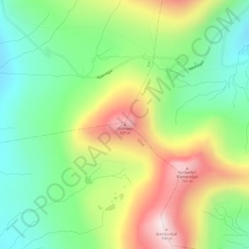
Name: Vaðhorn topographic map, elevation, terrain.
Location: Vaðhorn, Ljósá, Eysturoyar sýsla, 475, Færøerne (62.27822 -7.01372 62.27832 -7.01362)
Average elevation: 403 m
Minimum elevation: 155 m
Maximum elevation: 783 m
Thank you for supporting this site ❤️
Make a donation
Make a donation