

Puerto Vallarta topographic map
Click on the map to display elevation.
Puerto Vallarta
In 1968, the Puerto Vallarta municipality was elevated to City status. The elevation in status reflected interest by Mexican federal and state governments in developing the Puerto Vallarta as an international resort destination. Puerto Vallarta has since also attracted a lively immigrant community from the U.S., Canada and Europe.
About this map
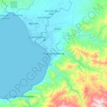
Name: Puerto Vallarta topographic map, elevation, terrain.
Location: Puerto Vallarta, Jalisco, 48300, Mexico (20.48072 -105.38031 20.80072 -105.06031)
Average elevation: 306 m
Minimum elevation: 0 m
Maximum elevation: 1,881 m