
Thank you for supporting this site ❤️
Make a donation
Make a donation
Tunas Harapan topographic map
Click on the map to display elevation.
Thank you for supporting this site ❤️
Make a donation
Make a donation
About this map
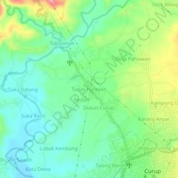
Name: Tunas Harapan topographic map, elevation, terrain.
Location: Tunas Harapan, Rejang Lebong, Bengkulu, Sumatra, Indonesia (-3.46921 102.49580 -3.42921 102.53580)
Average elevation: 639 m
Minimum elevation: 591 m
Maximum elevation: 738 m
Thank you for supporting this site ❤️
Make a donation
Make a donation