
Thank you for supporting this site ❤️
Make a donation
Make a donation
Newport City topographic map
Click on the map to display elevation.
Thank you for supporting this site ❤️
Make a donation
Make a donation
About this map
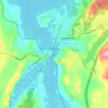
Name: Newport City topographic map, elevation, terrain.
Location: Newport City, Orleans County, Vermont, 05855, United States (44.90087 -72.24367 44.96618 -72.16958)
Average elevation: 251 m
Minimum elevation: 203 m
Maximum elevation: 399 m
Thank you for supporting this site ❤️
Make a donation
Make a donation
Other topographic maps
Click on a map to view its topography, its elevation and its terrain.
Thank you for supporting this site ❤️
Make a donation
Make a donation
Thank you for supporting this site ❤️
Make a donation
Make a donation