
Thank you for supporting this site ❤️
Make a donation
Make a donation
Sdérot topographic map
Click on the map to display elevation.
Thank you for supporting this site ❤️
Make a donation
Make a donation
About this map
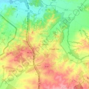
Name: Sdérot topographic map, elevation, terrain.
Location: Sdérot, sous-district d'Ashkelon, District sud, Israël (31.48647 34.55697 31.56647 34.63697)
Average elevation: 84 m
Minimum elevation: 28 m
Maximum elevation: 145 m
Thank you for supporting this site ❤️
Make a donation
Make a donation