
Thank you for supporting this site ❤️
Make a donation
Make a donation
Modrički Lug topographic map
Click on the map to display elevation.
Thank you for supporting this site ❤️
Make a donation
Make a donation
About this map
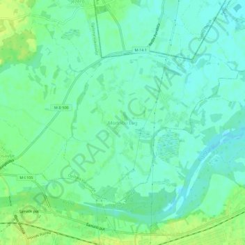
Name: Modrički Lug topographic map, elevation, terrain.
Average elevation: 100 m
Minimum elevation: 93 m
Maximum elevation: 110 m
Thank you for supporting this site ❤️
Make a donation
Make a donation
Other topographic maps
Click on a map to view its topography, its elevation and its terrain.
Jahorina
Bosnië en Herzegovina > Servische Republiek > Град Источно Сарајево / Grad Istočno Sarajevo
Average elevation: 1,131 m
Thank you for supporting this site ❤️
Make a donation
Make a donation