
Thank you for supporting this site ❤️
Make a donation
Make a donation
Görväln topographic map
Click on the map to display elevation.
Thank you for supporting this site ❤️
Make a donation
Make a donation
About this map
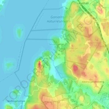
Name: Görväln topographic map, elevation, terrain.
Location: Görväln, Järfälla kommun, Stockholms län, 175 46, Sverige (59.41528 17.76587 59.45528 17.80587)
Average elevation: 17 m
Minimum elevation: -1 m
Maximum elevation: 57 m
Thank you for supporting this site ❤️
Make a donation
Make a donation