
Thank you for supporting this site ❤️
Make a donation
Make a donation
Puerto Gaitán topographic map
Click on the map to display elevation.
Thank you for supporting this site ❤️
Make a donation
Make a donation
About this map
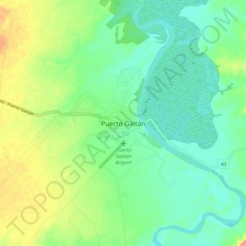
Name: Puerto Gaitán topographic map, elevation, terrain.
Location: Puerto Gaitán, Puerto Carreño, Rio Meta, Meta, 86084, Colombia (4.27207 -72.12295 4.35207 -72.04295)
Average elevation: 161 m
Minimum elevation: 137 m
Maximum elevation: 209 m
Thank you for supporting this site ❤️
Make a donation
Make a donation