
Thank you for supporting this site ❤️
Make a donation
Make a donation
Kronberg im Taunus topographic map
Click on the map to display elevation.
Thank you for supporting this site ❤️
Make a donation
Make a donation
About this map
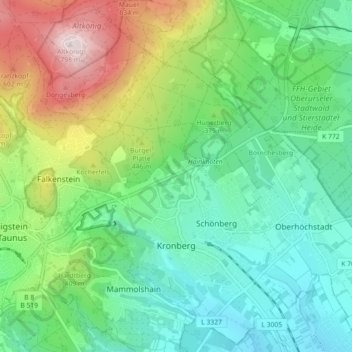
Name: Kronberg im Taunus topographic map, elevation, terrain.
Location: Kronberg im Taunus, Hochtaunuskreis, Hesse, 61476, Germany (50.16326 8.47459 50.21819 8.56435)
Average elevation: 325 m
Minimum elevation: 159 m
Maximum elevation: 791 m
Thank you for supporting this site ❤️
Make a donation
Make a donation