
Thank you for supporting this site ❤️
Make a donation
Make a donation
Villalebrín topographic map
Click on the map to display elevation.
Thank you for supporting this site ❤️
Make a donation
Make a donation
About this map
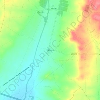
Name: Villalebrín topographic map, elevation, terrain.
Location: Villalebrín, Sahagún, León, Castilla y León, España (42.37463 -5.00124 42.41463 -4.96124)
Average elevation: 849 m
Minimum elevation: 813 m
Maximum elevation: 904 m
Thank you for supporting this site ❤️
Make a donation
Make a donation