
Thank you for supporting this site ❤️
Make a donation
Make a donation
Kempten (Allgäu) topographic map
Click on the map to display elevation.
Thank you for supporting this site ❤️
Make a donation
Make a donation
About this map
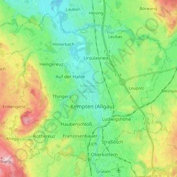
Name: Kempten (Allgäu) topographic map, elevation, terrain.
Location: Kempten (Allgäu), Bavaria, Germany (47.69459 10.23266 47.77795 10.37806)
Average elevation: 737 m
Minimum elevation: 640 m
Maximum elevation: 949 m
Thank you for supporting this site ❤️
Make a donation
Make a donation
Other topographic maps
Click on a map to view its topography, its elevation and its terrain.