
Thank you for supporting this site ❤️
Make a donation
Make a donation
Skúvafjall topographic map
Click on the map to display elevation.
Thank you for supporting this site ❤️
Make a donation
Make a donation
About this map
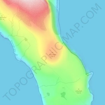
Name: Skúvafjall topographic map, elevation, terrain.
Location: Skúvafjall, Nólsoy, Streymoyar sýsla, 270, Færøerne (61.97083 -6.63473 61.97093 -6.63463)
Average elevation: 80 m
Minimum elevation: -31 m
Maximum elevation: 320 m
Thank you for supporting this site ❤️
Make a donation
Make a donation