
Thank you for supporting this site ❤️
Make a donation
Make a donation
Röshult topographic map
Click on the map to display elevation.
Thank you for supporting this site ❤️
Make a donation
Make a donation
About this map
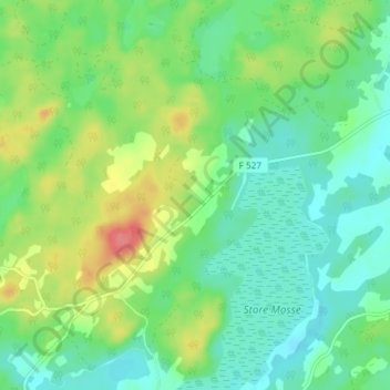
Name: Röshult topographic map, elevation, terrain.
Location: Röshult, Gislaveds kommun, Jönköping len, Sverige (57.08170 13.13341 57.12170 13.17341)
Average elevation: 134 m
Minimum elevation: 111 m
Maximum elevation: 180 m
Thank you for supporting this site ❤️
Make a donation
Make a donation
Other topographic maps
Click on a map to view its topography, its elevation and its terrain.