
Thank you for supporting this site ❤️
Make a donation
Make a donation
Mont Valier topographic map
Click on the map to display elevation.
Thank you for supporting this site ❤️
Make a donation
Make a donation
Mont Valier
On August 18, 2023, French general Jean-Louis Georgelin fell to his death while hiking on Mont Valier, at an altitude of 2,650 metres (8,690 ft).
Thank you for supporting this site ❤️
Make a donation
Make a donation
About this map
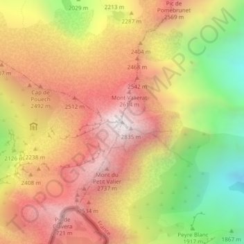
Name: Mont Valier topographic map, elevation, terrain.
Average elevation: 2,217 m
Minimum elevation: 1,454 m
Maximum elevation: 2,812 m
Thank you for supporting this site ❤️
Make a donation
Make a donation