
Thank you for supporting this site ❤️
Make a donation
Make a donation
Vítkov topographic map
Click on the map to display elevation.
Thank you for supporting this site ❤️
Make a donation
Make a donation
About this map
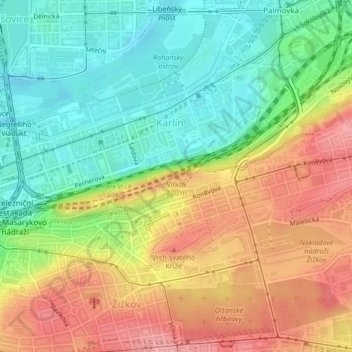
Name: Vítkov topographic map, elevation, terrain.
Location: Vítkov, Prague, 13000, Czechia (50.09070 14.46084 50.09080 14.46094)
Average elevation: 229 m
Minimum elevation: 181 m
Maximum elevation: 286 m
Thank you for supporting this site ❤️
Make a donation
Make a donation
Other topographic maps
Click on a map to view its topography, its elevation and its terrain.
Letná Park
Letná Park (Czech: Letenské sady) is a large park on Letná hill, built on a plateau above steep embankments along the Vltava River in Prague, Czech Republic. Letná's elevation and location afford commanding views of the Prague Old Town (Staré Město).
Average elevation: 214 m
Thank you for supporting this site ❤️
Make a donation
Make a donation