
Thank you for supporting this site ❤️
Make a donation
Make a donation
Norðarafjall topographic map
Click on the map to display elevation.
Thank you for supporting this site ❤️
Make a donation
Make a donation
About this map
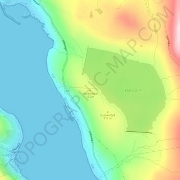
Name: Norðarafjall topographic map, elevation, terrain.
Location: Norðarafjall, Eiði, Eysturoyar sýsla, 470, Færøerne (62.28512 -7.06775 62.28522 -7.06765)
Average elevation: 97 m
Minimum elevation: -3 m
Maximum elevation: 310 m
Thank you for supporting this site ❤️
Make a donation
Make a donation