
Thank you for supporting this site ❤️
Make a donation
Make a donation
Province of Pataz topographic map
Click on the map to display elevation.
Thank you for supporting this site ❤️
Make a donation
Make a donation
About this map
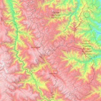
Name: Province of Pataz topographic map, elevation, terrain.
Location: Province of Pataz, La Libertad, Peru (-8.53327 -77.70093 -7.59323 -76.90124)
Average elevation: 2,998 m
Minimum elevation: 730 m
Maximum elevation: 4,872 m
Thank you for supporting this site ❤️
Make a donation
Make a donation