
Thank you for supporting this site ❤️
Make a donation
Make a donation
Bláfjöll topographic map
Click on the map to display elevation.
Thank you for supporting this site ❤️
Make a donation
Make a donation
About this map
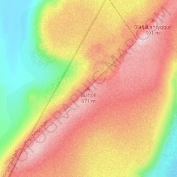
Name: Bláfjöll topographic map, elevation, terrain.
Location: Bláfjöll, Sveitarfélagið Ölfus, Southern Region, Iceland (63.99956 -21.58604 63.99966 -21.58594)
Average elevation: 539 m
Minimum elevation: 377 m
Maximum elevation: 669 m
Thank you for supporting this site ❤️
Make a donation
Make a donation
Other topographic maps
Click on a map to view its topography, its elevation and its terrain.