
Thank you for supporting this site ❤️
Make a donation
Make a donation
Hörnefors topographic map
Click on the map to display elevation.
Thank you for supporting this site ❤️
Make a donation
Make a donation
About this map
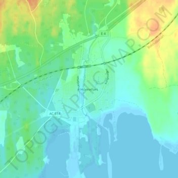
Name: Hörnefors topographic map, elevation, terrain.
Location: Hörnefors, Umeå kommun, Västerbottens län, 910 20, Zweden (63.60786 19.89410 63.64786 19.93410)
Average elevation: 9 m
Minimum elevation: -2 m
Maximum elevation: 32 m
Thank you for supporting this site ❤️
Make a donation
Make a donation
Other topographic maps
Click on a map to view its topography, its elevation and its terrain.