
Thank you for supporting this site ❤️
Make a donation
Make a donation
Cântaro Magro topographic map
Click on the map to display elevation.
Thank you for supporting this site ❤️
Make a donation
Make a donation
About this map
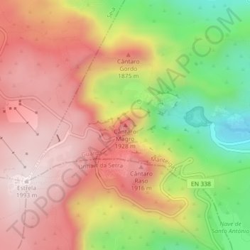
Name: Cântaro Magro topographic map, elevation, terrain.
Location: Cântaro Magro, Manteigas, Guarda, Portugal (40.32796 -7.59902 40.32806 -7.59892)
Average elevation: 1,725 m
Minimum elevation: 1,367 m
Maximum elevation: 1,993 m
Thank you for supporting this site ❤️
Make a donation
Make a donation