
Thank you for supporting this site ❤️
Make a donation
Make a donation
Estoril topographic map
Click on the map to display elevation.
Thank you for supporting this site ❤️
Make a donation
Make a donation
About this map
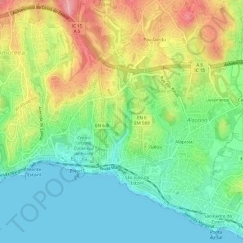
Name: Estoril topographic map, elevation, terrain.
Location: Estoril, Cascais e Estoril, Cascais, Lisbon, Portugal (38.69207 -9.41303 38.72735 -9.36656)
Average elevation: 49 m
Minimum elevation: 0 m
Maximum elevation: 130 m
Thank you for supporting this site ❤️
Make a donation
Make a donation
Other topographic maps
Click on a map to view its topography, its elevation and its terrain.