
Thank you for supporting this site ❤️
Make a donation
Make a donation
Serang topographic map
Click on the map to display elevation.
Thank you for supporting this site ❤️
Make a donation
Make a donation
About this map
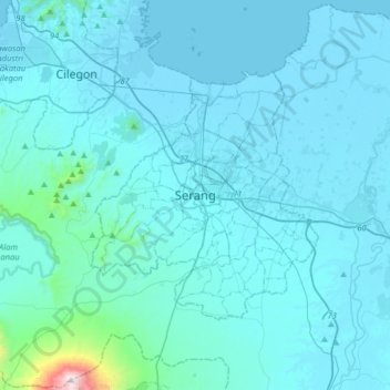
Name: Serang topographic map, elevation, terrain.
Location: Serang, Banten, Java, Indonesia (-6.27697 105.99181 -5.95697 106.31181)
Average elevation: 89 m
Minimum elevation: -1 m
Maximum elevation: 1,759 m
Thank you for supporting this site ❤️
Make a donation
Make a donation
Other topographic maps
Click on a map to view its topography, its elevation and its terrain.
Tangerang
Topographically, Tangerang City is mostly located at an altitude of 10–30 meters above sea level, aka the whole area is in the lowlands. The northern part of the city (covering most of Benda District) has an average height of 10 meters above sea level, while the southern part of Tangerang City has a height…
Average elevation: 16 m