
Thank you for supporting this site ❤️
Make a donation
Make a donation
Gívrufelli topographic map
Click on the map to display elevation.
Thank you for supporting this site ❤️
Make a donation
Make a donation
About this map
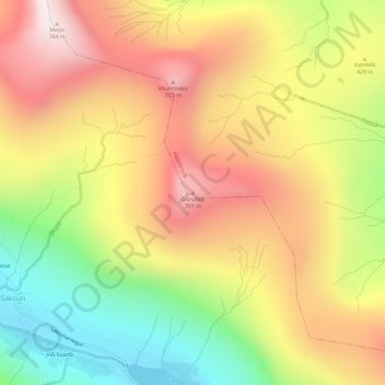
Name: Gívrufelli topographic map, elevation, terrain.
Location: Gívrufelli, Haldórsvík, Streymoyar sýsla, 440, Færøerne (62.25387 -7.15066 62.25397 -7.15056)
Average elevation: 408 m
Minimum elevation: 18 m
Maximum elevation: 764 m
Thank you for supporting this site ❤️
Make a donation
Make a donation