
Thank you for supporting this site ❤️
Make a donation
Make a donation
Reyðafelstindur topographic map
Click on the map to display elevation.
Thank you for supporting this site ❤️
Make a donation
Make a donation
About this map
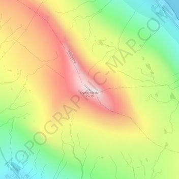
Name: Reyðafelstindur topographic map, elevation, terrain.
Location: Reyðafelstindur, Skálafjørður, Eysturoyar sýsla, 485, Færøerne (62.17432 -6.86219 62.17442 -6.86209)
Average elevation: 364 m
Minimum elevation: 0 m
Maximum elevation: 745 m
Thank you for supporting this site ❤️
Make a donation
Make a donation