
Thank you for supporting this site ❤️
Make a donation
Make a donation
Ingolstadt topographic map
Click on the map to display elevation.
Thank you for supporting this site ❤️
Make a donation
Make a donation
About this map
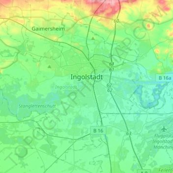
Name: Ingolstadt topographic map, elevation, terrain.
Location: Ingolstadt, Bavaria, Germany (48.68388 11.25591 48.82289 11.50342)
Average elevation: 378 m
Minimum elevation: 353 m
Maximum elevation: 464 m
Thank you for supporting this site ❤️
Make a donation
Make a donation
Other topographic maps
Click on a map to view its topography, its elevation and its terrain.