
Thank you for supporting this site ❤️
Make a donation
Make a donation
Le Grand-Saconnex topographic map
Click on the map to display elevation.
Thank you for supporting this site ❤️
Make a donation
Make a donation
About this map
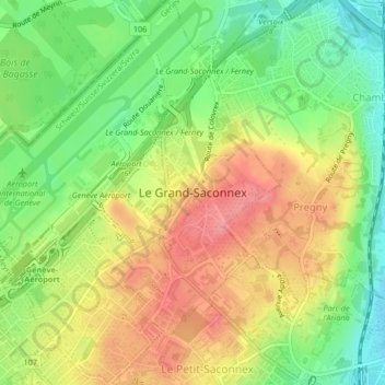
Name: Le Grand-Saconnex topographic map, elevation, terrain.
Location: Le Grand-Saconnex, Geneva, 1218, Switzerland (46.22193 6.10089 46.25065 6.13603)
Average elevation: 429 m
Minimum elevation: 386 m
Maximum elevation: 471 m
Thank you for supporting this site ❤️
Make a donation
Make a donation
Other topographic maps
Click on a map to view its topography, its elevation and its terrain.
Thank you for supporting this site ❤️
Make a donation
Make a donation
Le Grand-Saconnex
Switzerland > Geneva > Le Grand-Saconnex > Le Grand-Saconnex
Average elevation: 414 m
Thank you for supporting this site ❤️
Make a donation
Make a donation