
Thank you for supporting this site ❤️
Make a donation
Make a donation
Xuchitlán topographic map
Click on the map to display elevation.
Thank you for supporting this site ❤️
Make a donation
Make a donation
About this map
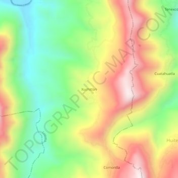
Name: Xuchitlán topographic map, elevation, terrain.
Location: Xuchitlán, Lolotla, Hidalgo, México (21.04507 -98.76435 21.08507 -98.72435)
Average elevation: 589 m
Minimum elevation: 230 m
Maximum elevation: 1,014 m
Thank you for supporting this site ❤️
Make a donation
Make a donation