
Thank you for supporting this site ❤️
Make a donation
Make a donation
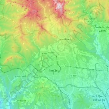
Terrassa topographic map
Click on the map to display elevation.
Thank you for supporting this site ❤️
Make a donation
Make a donation
Terrassa
The city is located in the Catalan Prelitoral depression (Depressió Prelitoral), at the feet of the Prelitoral mountain range (natural reserve of Sant Llorenç del Munt [ca]) and the average altitude of the city is 277 meters above sea level. It is 20 and 18 kilometres from Barcelona and Montserrat respectively.
Thank you for supporting this site ❤️
Make a donation
Make a donation
About this map
Name: Terrassa topographic map, elevation, terrain.
Location: Terrassa, Vallès Occidental, Barcelona, Catalonia, Spain (41.51630 1.94358 41.64872 2.06882)
Average elevation: 383 m
Minimum elevation: 93 m
Maximum elevation: 1,090 m
Thank you for supporting this site ❤️
Make a donation
Make a donation