
Thank you for supporting this site ❤️
Make a donation
Make a donation
Møllsbygda topographic map
Click on the map to display elevation.
Thank you for supporting this site ❤️
Make a donation
Make a donation
About this map
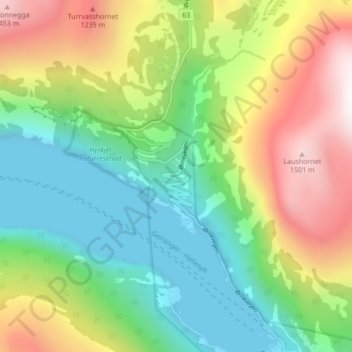
Name: Møllsbygda topographic map, elevation, terrain.
Location: Møllsbygda, Stranda, Мёре-ог-Ромсдал, 6216, Норвегия (62.10078 7.16146 62.14078 7.20146)
Average elevation: 587 m
Minimum elevation: -7 m
Maximum elevation: 1,600 m
Thank you for supporting this site ❤️
Make a donation
Make a donation
Other topographic maps
Click on a map to view its topography, its elevation and its terrain.