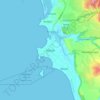
Mumbai topographic map
Click on the map to display elevation.
Mumbai
Mumbai is on a narrow peninsula on the southwest of Salsette Island, which lies between the Arabian Sea to the west, Thane Creek to the east and Vasai Creek to the north. Mumbai's suburban district occupies most of the island. Navi Mumbai is east of Thane Creek and Thane is north of Vasai Creek. Mumbai consists of two distinct regions: Mumbai City district and Mumbai Suburban district, which form two separate revenue districts of Maharashtra. The city district region is also commonly referred to as the Island City or South Mumbai. The total area of Mumbai is 603.4 square kilometres (233.0 sq mi). Of this, the island city spans 67.79 square kilometres (26.17 sq mi), while the suburban district spans 370 square kilometres (140 sq mi), together accounting for 437.71 square kilometres (169.00 sq mi) under the administration of Municipal Corporation of Greater Mumbai (MCGM). The remaining areas belong to various Defence establishments, the Mumbai Port Trust, the Atomic Energy Commission and the Borivali National Park, which are out of the jurisdiction of the MCGM. The Mumbai Metropolitan Region which includes portions of Thane, Palghar and Raigad districts in addition to Greater Mumbai, covers an area of 4,355 square kilometres (1,681 sq mi). Mumbai lies at the mouth of the Ulhas River on the western coast of India, in the coastal region known as the Konkan. It sits on Salsette Island (Sashti Island), which it partially shares with the Thane district. Mumbai is bounded by the Arabian Sea to the west. Many parts of the city lie just above sea level, with elevations ranging from 10 to 15 metres (33 to 49 ft); the city has an average elevation of 14 metres (46 ft). Northern Mumbai (Salsette) is hilly, and the highest point in the city is 450 metres (1,480 ft) at Salsette in the Powai–Kanheri ranges. The Sanjay Gandhi National Park (Borivali National Park) is located partly in the Mumbai suburban district, and partly in the Thane district, and it extends over an area of 103.09 square kilometres (39.80 sq mi).
About this map
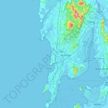
Name: Mumbai topographic map, elevation, terrain.
Location: Mumbai, Mumbai Suburban, Maharashtra, India (18.89396 72.77633 19.26948 72.98175)
Average elevation: 18 m
Minimum elevation: -3 m
Maximum elevation: 477 m
Other topographic maps
Click on a map to view its topography, its elevation and its terrain.
Nandgaon Khandeshwar
India > Maharashtra > Nandgaon-Khandeshwar > Nandgaon Khandeshwar
Average elevation: 302 m
Maharashtra
Maharashtra is the third largest state by area in India. The Western Ghats better known as Sahyadri, are a hilly range running parallel to the coast, at an average elevation of 1,200 metres (4,000 ft). Kalsubai, a peak in the Sahyadris, near Nashik city is the highest elevated point in Maharashtra. To the west…
Average elevation: 478 m
Mumbai
Mumbai lies at the mouth of the Ulhas River on the western coast of India, in the coastal region known as the Konkan. It sits on Salsette Island (Sashti Island), which it partially shares with the Thane district. Mumbai is bounded by the Arabian Sea to the west. Many parts of the city lie just above sea level,…
Average elevation: 13 m
Mahad
India > Maharashtra > Mahad Taluka
Several disasters like floods and landslides have continuously devastated markets and old houses, specifically classic Konkani-styled architecture, causing great loss of life. This is primarily due to lower elevation of the city compared to surrounding areas and being surrounded by rivers on all sides, making…
Average elevation: 75 m

Dombivli
India > Maharashtra > Kalyan Subdistrict > Kalyan-Dombivli
Dombivli is located at 19°13′06″N 73°05′12″E / 19.218433°N 73.086718°E / 19.218433; 73.086718. It has an average elevation of 13.534 meters (44.403 feet). The land here is rough and rocky by nature. The Ulhas river flows from its north.
Average elevation: 11 m





Panvel
India > Maharashtra > Panvel > Panvel
Matheran is a hill station and a municipal council in the Raigad district in the Indian state of Maharashtra. It is a hill station in Karjat Tahsil and is also the smallest hill station in India. It is located on the Western Ghats range at an elevation of around 800 m (2,625 feet) above sea level. It is…
Average elevation: 75 m




Navi Mumbai
India > Maharashtra > Thane > Navi Mumbai
Navi Mumbai (Marathi pronunciation: , also known by its former name New Bombay), is a planned city off the west coast of the Indian state of Maharashtra in Konkan division. The city is divided into two parts, North Navi Mumbai and South Navi Mumbai, for the individual development of Panvel Mega City, which…
Average elevation: 30 m
Lonavala
India > Maharashtra > Mawal
Adjacent to the Lohagad fort lies the visapur fort which is part of the Lohagad-Visapur fortification. Visapur Fort is larger and at a higher elevation than its twin- Lohagad. It was built during 1713-1720 CE by Balaji Vishwanath.
Average elevation: 613 m
Amravati
India > Maharashtra > Amravati
Amravati is located at 20°56′N 77°45′E / 20.93°N 77.75°E / 20.93; 77.75. It has an average elevation of 343 meters (1125 feet). It lies 156 km (97 mi) west of Nagpur and serves as the administrative centre of Amravati District and of Amravati Division. The city is located near the passes…
Average elevation: 345 m
Pench (Indira Priyadarsini) National Park/Tiger Reserve
India > Maharashtra > Ramtek Taluka
Average elevation: 485 m
Nashik
India > Maharashtra > Nashik Subdistrict
The city's tropical location and high altitude combine to give it a relatively mild version of a tropical wet and dry climate (Köppen Aw). Temperatures rise slightly in October, but this is followed by the cool season from November to February. The cool season sees warm temperatures of around 28 °C or 82.4…
Average elevation: 631 m










Parbhani
India > Maharashtra > Parbhani
Parbhani is located at 19°16′N 76°47′E / 19.27°N 76.78°E / 19.27; 76.78. It has an average elevation of 347 metres.
Average elevation: 411 m
Alibag
India > Maharashtra > Alibag Taluka
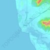
Alibag is located about 120 km south of Mumbai, at 18°38′29″N 72°52′20″E / 18.64139°N 72.87222°E / 18.64139; 72.87222. The average elevation is 0 metres (0 feet).The District Government offices are located along the sea coast road. Alibag is the center place of Raigad District.
Average elevation: 12 m
Solapur
India > Maharashtra > Solapur North
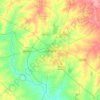
Solapur is located at 17°41′N 75°55′E / 17.68°N 75.92°E / 17.68; 75.92. It has an average elevation of 458 metres (1502 feet). It is bordered by Ahmednagar district on the north; Osmanabad district on the north and northeast.
Average elevation: 469 m











Talegaon Dabhade
India > Maharashtra > Mawal
Talegaon Dabhade has an altitude of 672 meters from sea level (2200 Ft), and thus enjoys pleasant weather round the year. Situated on the laps of Sahyadri mountain ranges, during monsoon rains, Talegaon Dabhade witnesses heavy rainfall adding to its overall natural beauty. Indrayani River, which originates in…
Average elevation: 616 m