
Thank you for supporting this site ❤️
Make a donation
Make a donation
Kiełkowice topographic map
Click on the map to display elevation.
Thank you for supporting this site ❤️
Make a donation
Make a donation
About this map
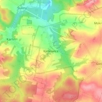
Name: Kiełkowice topographic map, elevation, terrain.
Average elevation: 391 m
Minimum elevation: 337 m
Maximum elevation: 438 m
Thank you for supporting this site ❤️
Make a donation
Make a donation
Other topographic maps
Click on a map to view its topography, its elevation and its terrain.
Park Krajobrazowy Orlich Gniazd
Poland > Silesian Voivodeship > Zawiercie County > Rzędkowice
Average elevation: 310 m
Thank you for supporting this site ❤️
Make a donation
Make a donation