
Thank you for supporting this site ❤️
Make a donation
Make a donation
Segamat topographic map
Click on the map to display elevation.
Thank you for supporting this site ❤️
Make a donation
Make a donation
About this map
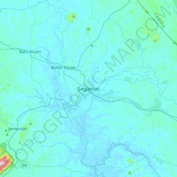
Name: Segamat topographic map, elevation, terrain.
Location: Segamat, Johor, 85000, Malaysia (2.35240 102.65374 2.67240 102.97374)
Average elevation: 33 m
Minimum elevation: 3 m
Maximum elevation: 643 m
Thank you for supporting this site ❤️
Make a donation
Make a donation
Other topographic maps
Click on a map to view its topography, its elevation and its terrain.
Thank you for supporting this site ❤️
Make a donation
Make a donation