
Thank you for supporting this site ❤️
Make a donation
Make a donation
Senhora da Rocha topographic map
Click on the map to display elevation.
Thank you for supporting this site ❤️
Make a donation
Make a donation
About this map
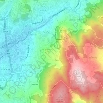
Name: Senhora da Rocha topographic map, elevation, terrain.
Location: Senhora da Rocha, Nogueiró e Tenões, Braga, 4715, Portugal (41.53007 -8.40337 41.57007 -8.36337)
Average elevation: 320 m
Minimum elevation: 172 m
Maximum elevation: 570 m
Thank you for supporting this site ❤️
Make a donation
Make a donation
Other topographic maps
Click on a map to view its topography, its elevation and its terrain.