
Thank you for supporting this site ❤️
Make a donation
Make a donation
Ozark Acres topographic map
Click on the map to display elevation.
Thank you for supporting this site ❤️
Make a donation
Make a donation
About this map
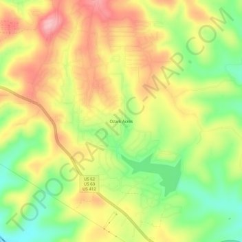
Name: Ozark Acres topographic map, elevation, terrain.
Location: Ozark Acres, Sharp County, Arkansas, 72482, United States (36.27479 -91.40291 36.31479 -91.36291)
Average elevation: 177 m
Minimum elevation: 98 m
Maximum elevation: 251 m
Thank you for supporting this site ❤️
Make a donation
Make a donation