
Thank you for supporting this site ❤️
Make a donation
Make a donation
Jura topographic map
Click on the map to display elevation.
Thank you for supporting this site ❤️
Make a donation
Make a donation
Jura
The climate of the Jura varies greatly by elevation. The lower valleys are temperate and pleasant, but the high mountain valleys have bitterly cold winters.
Thank you for supporting this site ❤️
Make a donation
Make a donation
About this map
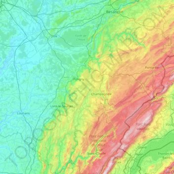
Name: Jura topographic map, elevation, terrain.
Location: Jura, Bourgogne-Franche-Comté, Metropolitan France, France (46.26102 5.25202 47.30576 6.20739)
Average elevation: 509 m
Minimum elevation: 174 m
Maximum elevation: 1,703 m
Thank you for supporting this site ❤️
Make a donation
Make a donation