
Thank you for supporting this site ❤️
Make a donation
Make a donation
Río Retobo topographic map
Click on the map to display elevation.
Thank you for supporting this site ❤️
Make a donation
Make a donation
About this map
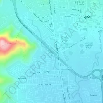
Name: Río Retobo topographic map, elevation, terrain.
Average elevation: 527 m
Minimum elevation: 498 m
Maximum elevation: 715 m
Thank you for supporting this site ❤️
Make a donation
Make a donation
Other topographic maps
Click on a map to view its topography, its elevation and its terrain.
Cerro El Café
Venezuela > Estado Carabobo > Municipio Naguanagua > Naguanagua
Average elevation: 1,110 m