
Thank you for supporting this site ❤️
Make a donation
Make a donation
Torød topographic map
Click on the map to display elevation.
Thank you for supporting this site ❤️
Make a donation
Make a donation
About this map
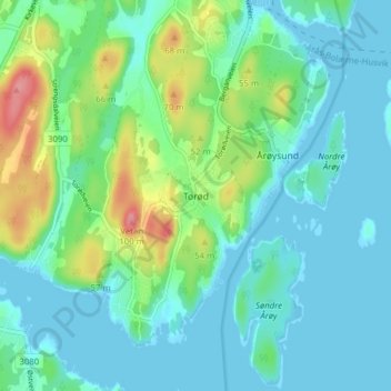
Name: Torød topographic map, elevation, terrain.
Location: Torød, Færder, Vestfold og Telemark, 3135, Norway (59.15900 10.42112 59.19900 10.46112)
Average elevation: 21 m
Minimum elevation: -1 m
Maximum elevation: 88 m
Thank you for supporting this site ❤️
Make a donation
Make a donation