
Thank you for supporting this site ❤️
Make a donation
Make a donation
La Ruà topographic map
Click on the map to display elevation.
Thank you for supporting this site ❤️
Make a donation
Make a donation
About this map
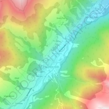
Name: La Ruà topographic map, elevation, terrain.
Location: La Ruà, Pragelato, Torino, Piedmont, Italy (44.99577 6.92125 45.03577 6.96125)
Average elevation: 1,870 m
Minimum elevation: 1,438 m
Maximum elevation: 2,585 m
Thank you for supporting this site ❤️
Make a donation
Make a donation