
Thank you for supporting this site ❤️
Make a donation
Make a donation
Cúllar topographic map
Click on the map to display elevation.
Thank you for supporting this site ❤️
Make a donation
Make a donation
About this map
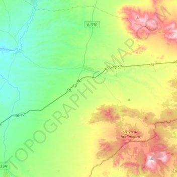
Name: Cúllar topographic map, elevation, terrain.
Location: Cúllar, Comarca de Baza, Grenade, Andalousie, Espagne (37.44265 -2.66694 37.67149 -2.35539)
Average elevation: 999 m
Minimum elevation: 657 m
Maximum elevation: 1,715 m
Thank you for supporting this site ❤️
Make a donation
Make a donation