
Thank you for supporting this site ❤️
Make a donation
Make a donation
Haldenköpfle topographic map
Click on the map to display elevation.
Thank you for supporting this site ❤️
Make a donation
Make a donation
About this map
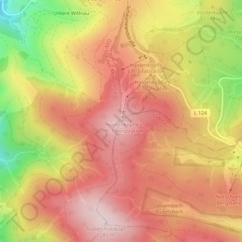
Name: Haldenköpfle topographic map, elevation, terrain.
Average elevation: 1,138 m
Minimum elevation: 900 m
Maximum elevation: 1,281 m
Thank you for supporting this site ❤️
Make a donation
Make a donation
Other topographic maps
Click on a map to view its topography, its elevation and its terrain.
St. Wilhelm
Deutschland > Baden-Württemberg > Landkreis Breisgau-Hochschwarzwald > Oberried
Average elevation: 1,052 m