
Thank you for supporting this site ❤️
Make a donation
Make a donation
Nelle topographic map
Click on the map to display elevation.
Thank you for supporting this site ❤️
Make a donation
Make a donation
About this map
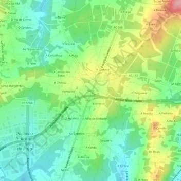
Name: Nelle topographic map, elevation, terrain.
Location: Nelle, Castro, Narón, Ferrol, A Coruña, Galicia, 15573, Spain (43.52671 -8.19655 43.56671 -8.15655)
Average elevation: 66 m
Minimum elevation: 17 m
Maximum elevation: 152 m
Thank you for supporting this site ❤️
Make a donation
Make a donation
Other topographic maps
Click on a map to view its topography, its elevation and its terrain.