
Thank you for supporting this site ❤️
Make a donation
Make a donation
Västerhejde topographic map
Click on the map to display elevation.
Thank you for supporting this site ❤️
Make a donation
Make a donation
About this map
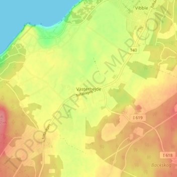
Name: Västerhejde topographic map, elevation, terrain.
Location: Västerhejde, Gotlands kommun, Gotlands län, 622 61, Sverige (57.56559 18.20733 57.60559 18.24733)
Average elevation: 42 m
Minimum elevation: 0 m
Maximum elevation: 74 m
Thank you for supporting this site ❤️
Make a donation
Make a donation
Other topographic maps
Click on a map to view its topography, its elevation and its terrain.