
Thank you for supporting this site ❤️
Make a donation
Make a donation
Kirkjubøkambur topographic map
Click on the map to display elevation.
Thank you for supporting this site ❤️
Make a donation
Make a donation
About this map
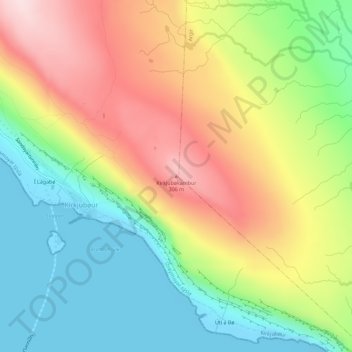
Name: Kirkjubøkambur topographic map, elevation, terrain.
Location: Kirkjubøkambur, Kirkjubøur, Streymoyar sýsla, 175, Færøerne (61.95475 -6.77880 61.95485 -6.77870)
Average elevation: 139 m
Minimum elevation: -12 m
Maximum elevation: 319 m
Thank you for supporting this site ❤️
Make a donation
Make a donation