
Thank you for supporting this site ❤️
Make a donation
Make a donation
General Güemes topographic map
Click on the map to display elevation.
Thank you for supporting this site ❤️
Make a donation
Make a donation
About this map
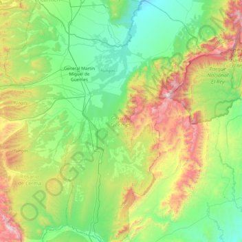
Name: General Güemes topographic map, elevation, terrain.
Location: General Güemes, Salta, Argentina (-25.14895 -65.30157 -24.46657 -64.64008)
Average elevation: 1,022 m
Minimum elevation: 529 m
Maximum elevation: 2,386 m
Thank you for supporting this site ❤️
Make a donation
Make a donation
Other topographic maps
Click on a map to view its topography, its elevation and its terrain.