
Thank you for supporting this site ❤️
Make a donation
Make a donation
Culiacán topographic map
Click on the map to display elevation.
Thank you for supporting this site ❤️
Make a donation
Make a donation
Culiacán
Culiacán is located in the central region of the State of Sinaloa, forming part of the Northwest of Mexico. The coordinates that correspond to it are 24 ° 48'15 "N (latitude) by 107 ° 25'52" W (West), with an altitude of 54 meters above sea level.
Thank you for supporting this site ❤️
Make a donation
Make a donation
About this map
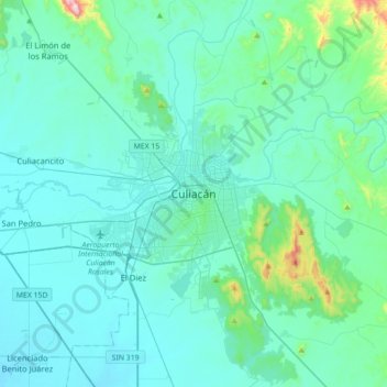
Name: Culiacán topographic map, elevation, terrain.
Average elevation: 85 m
Minimum elevation: 6 m
Maximum elevation: 764 m
Thank you for supporting this site ❤️
Make a donation
Make a donation