
Thank you for supporting this site ❤️
Make a donation
Make a donation
Yerköy topographic map
Click on the map to display elevation.
Thank you for supporting this site ❤️
Make a donation
Make a donation
About this map
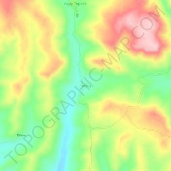
Name: Yerköy topographic map, elevation, terrain.
Location: Yerköy, Tekman, Erzurum, Eastern Anatolia Region, Turkey (39.69082 41.63547 39.73082 41.67547)
Average elevation: 2,102 m
Minimum elevation: 1,993 m
Maximum elevation: 2,223 m
Thank you for supporting this site ❤️
Make a donation
Make a donation