
Thank you for supporting this site ❤️
Make a donation
Make a donation
Alcarràs topographic map
Click on the map to display elevation.
Thank you for supporting this site ❤️
Make a donation
Make a donation
About this map
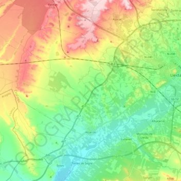
Name: Alcarràs topographic map, elevation, terrain.
Location: Alcarràs, Segrià, Lleida, Catalogna, 25180, Spagna (41.54344 0.34637 41.65815 0.56464)
Average elevation: 198 m
Minimum elevation: 105 m
Maximum elevation: 351 m
Thank you for supporting this site ❤️
Make a donation
Make a donation