
Thank you for supporting this site ❤️
Make a donation
Make a donation
Mont Péla topographic map
Click on the map to display elevation.
Thank you for supporting this site ❤️
Make a donation
Make a donation
About this map
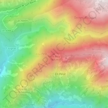
Name: Mont Péla topographic map, elevation, terrain.
Average elevation: 1,140 m
Minimum elevation: 658 m
Maximum elevation: 1,647 m
Thank you for supporting this site ❤️
Make a donation
Make a donation
Other topographic maps
Click on a map to view its topography, its elevation and its terrain.
Vallon de Crévillère
France > Provence-Alpes-Côte d'Azur > Alpes-Maritimes > La Bollène-Vésubie
Average elevation: 1,691 m
Vallon de Planquette
France > Provence-Alpes-Côte d'Azur > Alpes-Maritimes > La Bollène-Vésubie
Average elevation: 1,088 m